Explore Chianti
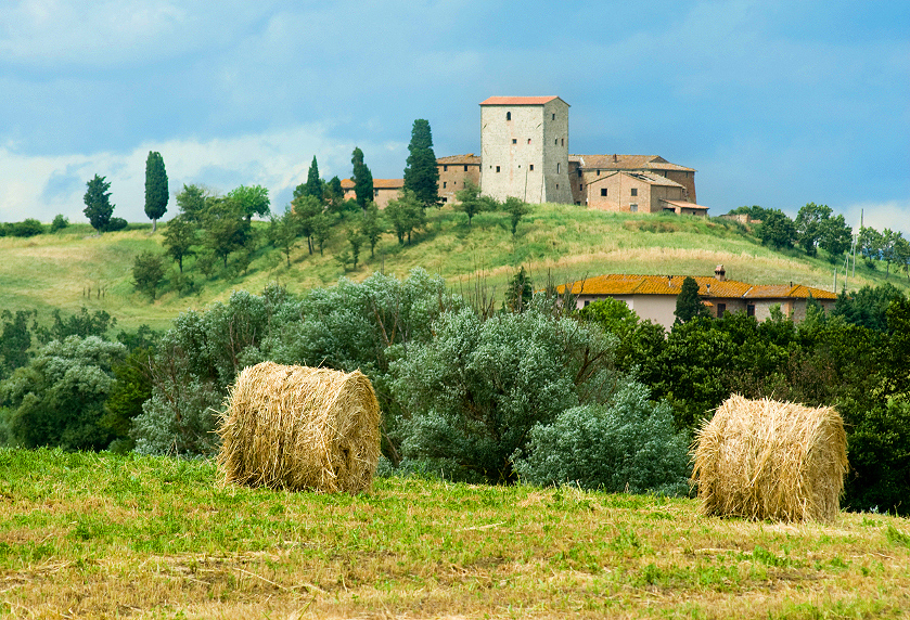
Explore Chianti or to put more precisely explore Florentine Chianti. What Florence has to offer is not confined to the limits of the city itself. The Tuscan region is revered throughout the world for the gentle slopes, the lush vineyards, the plentiful olive groves, and the picturesque farmhouses of its countryside.
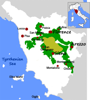
The given choices and possible destinations for a short day trip outside Florence are so many that are impossible for someone to cover in only a few days’ stay even if Florence was completely left out of the daily itinerary. The region of Chianti is considered one of the most if not the most picturesque in Tuscany. It is roughly the area between Florence and Siena, divided into Florentine Chianti (northern part) and Sienese Chianti (southern part).
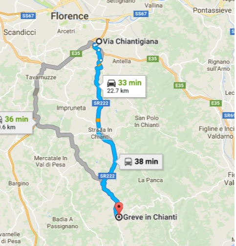
Through Via Chiantigiana, a road famous for its picturesque scenery, about an hour to the south lies Greve, the town gateway to the Chianti region. The world-renowned vineyards of Chianti are visible even before you cross the local government line of Greve in Chianti but it isn’t until you actually walk into the triangular-shaped square, with its stone pavement, and inhale the small town atmosphere that you can really truly say you are having a Chianti experience.
Looking at the tranquil atmosphere of this fairly busy little town, one would never guess that the town of Greve, and the headquarters of the local commune, had been caught in the crossfire of Florence and Sienna for hundreds of years. Once you pass through Greve’s borders, just outside of the town of Grassina, you will feel the air change, the vineyards will become more pronounced and wherever you turn there will be a sign on the road, boasting of vino for sale.
The convenient position close to public transport, main roads and of course the beautiful monuments of Florence point to the fact that Greve is a great base to find your villa rental or B&B suite and travel, exploring all of Tuscany. (Description by https://www.chianti.com/greve-in-chianti/)
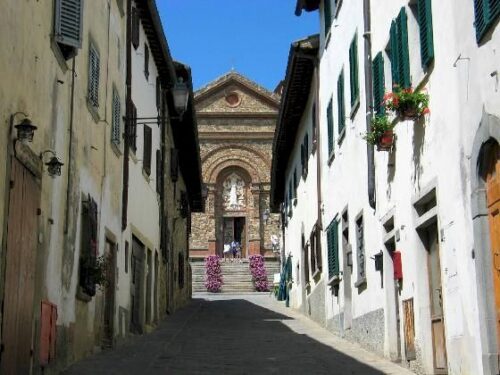
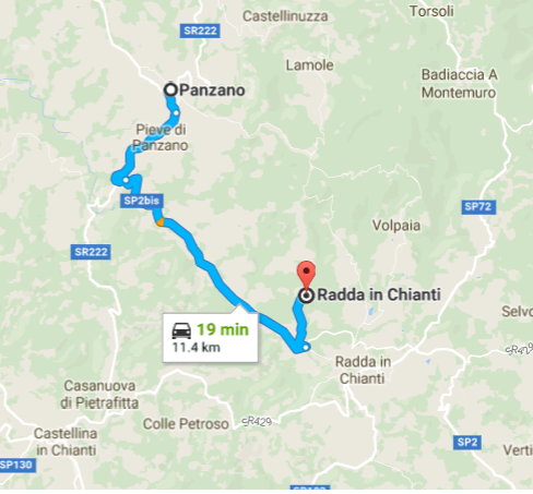
Next stop, about ten minutes away to the south again, the hilltop town of Panzano. The name of the village of Panzano is of Roman origin but the settlement is older since Etruscan finds have been made in the neighborhood. The first documentary evidence is 11 C, when the development of the “borgo”, the village around the castle, took place.
The castle stands on a ridge separating the Val di Greve from the Val di Pesa, exactly halfway between Florence and Sienna, between which it was always a source of contention. The castle is now private, but the courtyard and the surroundings can be visited, and the houses along the downhill road have a medieval character. There are some remnants of the old Roman paved roads, the Senice, which are still in use.
Panzano’s churches are definitely worth a visit: The Church of Santa Maria (Santa Maria Assunta), which stands next to the castle, was completely rebuilt in the 19 C on the site of an ancient church, but it possesses a small 14 C Siennese Madonna and Child attributed to Botticini. In the oratory through the little door to the right of the nave is an Annunciation attributed to Michele di Ridolfo del Ghirlandaio. Description and pictures by http://www.panzano.com/
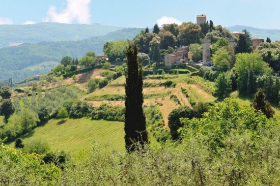
Next in line the wine village of Radda located between the valleys of the rivers Pesa and Arbia in central Italy, on a forested hillside surrounded by extensive vineyards. A small number of shops and restaurants in Radda in Chianti provide a supply center for the wineries of the nearby parts of Chianti. The surrounding Chianti hills are dotted with castles, some in ruins, some still inhabited.
There are numerous excellent agriturismi within easy reach of Radda in Chianti, providing vacation accommodation for tourists at highly competitive prices. There is no better way to enjoy the ambiance of Tuscany, Italy, than to stay in a Bed and Breakfast, farmhouse apartment, or villa on a working Tuscany vineyard. Radda in Chianti has limited bus service – a car is recommended. Description picture by http://www.radda-in-chianti.com/
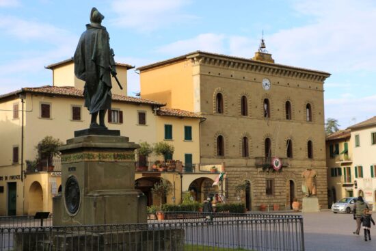
Among its main attractions, Radda has quite an interesting town hall, the Palazzo del Podestà, its facade decorated with the coats of arms of worthies of an earlier age. Radda also has a very photogenic fountain of remarkable splendor for such a small town. On the main piazza, you’ll find the Church of San Niccolò, a church of Romanesque origins that houses a venerated wooden Crucifix of the 15 C.
Other sights include the Ice House of the Grand Duke, built at the end of the 19 C to store snow and turn it into ice for cooling purposes. There is a Museum of Sacred Art in the Franciscan Convent of Santa Maria in Prato that displays several works of art from the Chianti region, including a valuable polyptych by Neri di Bicci (1474) depicting the Virgin Mary with Child and Saints. (There are several other similar Chianti museums of Sacred Art to be visited in Chianti.) Description by http://www.radda.org/
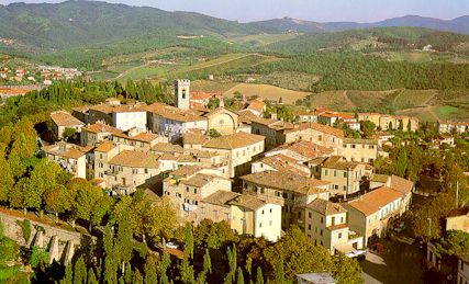
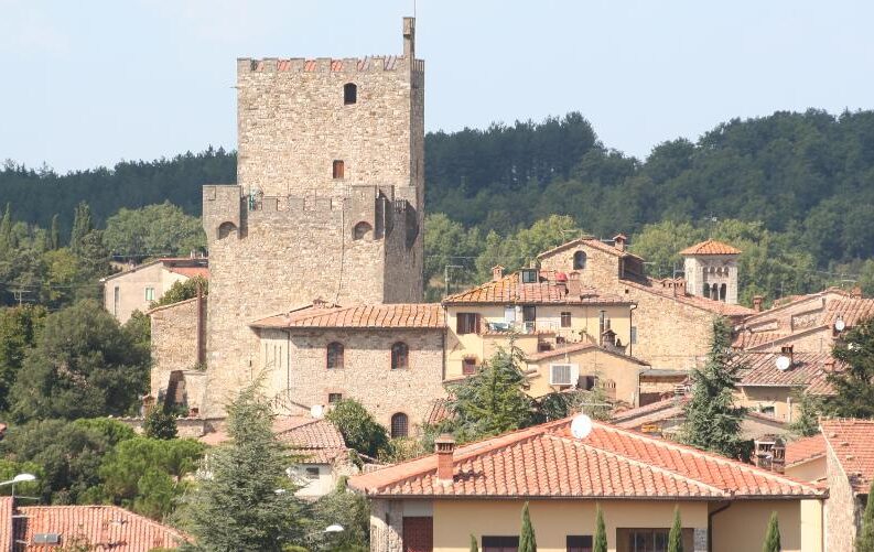
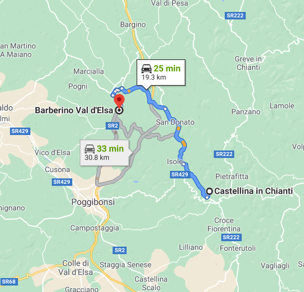
From Radda, about half an hour to the west lies Castellina in Chianti. The town is of Etruscan and Roman origin and was a fife of the nobles of Trebbio in the 11 C and then an important Florentine garrison. Castellina became the seat of local government for the ancient Chianti League together with Radda and Gaiole in the 13 C, but in the 14 and 15 C raids and pillaging were common. The Florentines built the town walls between 1400 and 1402. The wall is dominated by the fortress and huge keep, the Rocca Comunale of Castellina, and is characterized by underground vaulted passages such as the Via delle Volte.
The inhabited part of Castellina retains some of its 14 C characters, and in the countryside, there are many farmhouses from the era of the Grand Dukes of Florence and even earlier. Not far from the center of Castellina there is a large Etruscan tomb that dates back to 6 C BC.
The churches in the surrounding area are numerous and all interesting, particularly San Martino a Cispiano which has conserved most of its Romanesque features, including a beautiful apse and a single nave, and San Leonino in Conio which holds a Madonna and Child by Lorenzo di Bicci. The village of Fonterutoli, cited in a document from 998, has a long and interesting history. The peace agreement between Siena and Florence was signed in 1201 in its Church of San Miniato (since replaced). Description by http://www.castellina.com/

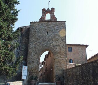
From Castellina, back north about half an hour away, sits Barberino Val d’Elsa. The town has retained its medieval elliptical shape with a main street running between the two turreted tower gates, the Porta Romana and the Porta Fiorentina. Two other streets run parallel with this main street and meet up with it again near the gates.
The type of urban structure seen in Barberino Val d’Elsa is fairly common among the walled towns of the Elsa Valley (Val d’Elsa) and has remained basically intact, although the town walls have suffered some mutilations here and there. The two gates still exist, though the Florentine Gate is a modern copy. The Sienna gate of Barberino Val d’Elsa, commonly known as “di sotto” (below), is built in stone. It boasts an elegant Gothic arch, while a small 18 C brick belfry can be seen above the main walls.

Barberino Val d’Elsa is mentioned in a document of 1054 belonging to the Abbey of Passignano as a fortress or village situated in the Parish of San Pietro in Bossolo. However, the town really developed as a municipality in the first decades of the 13 C after the Florentine destruction of Semifonte in 1202. The history of Barberino Val d’Elsa as a center of power in Tuscany, Italy, in fact hinges on the destruction of the castle of Semifonte. After a long siege, the castle was razed to the ground by Florence in 1202, and the Florentines forbade its reconstruction by anyone.
Today a dome identical to the Brunelleschi cupola, but five times smaller rises up on top of what was presumably the hill of Semifonte and stands as a permanent reminder of this tragic event. The razing of the castle of Semifonte, however, increased the importance of Barberino Val d’Elsa. In fact, Barberino Val d’Elsa became the administrative center of a “Barberino Val d’Elsa League”, which included more than 30 villages located in the area between the Pesa and Elsa valleys. Florence surrounded it with defensive walls and transformed it into a military garrison. It then became part of the Florentine Republic and a Podestà was installed as governor.
The main road that now runs past Barberino Val d’Elsa on the east once went right through the center so that merchants and pilgrims naturally had to pass this way, often stopping overnight. This explains the presence of the Pilgrim’s Hospice close by the Florentine Gate, commissioned in 1365 by Taddeo di Cecco, son of the poet and notary Francesco da Barberino. Description by http://www.barberinovaldelsa.info/
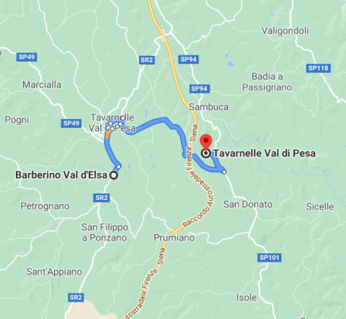
From Barberino a bit to the east and Tavernelle Val di Pesa. The village is of ancient origin but the current town is quite modern in appearance and in fact acquired such importance as it has in relatively recent times. It takes its name from its location in the valley of river Pesa.
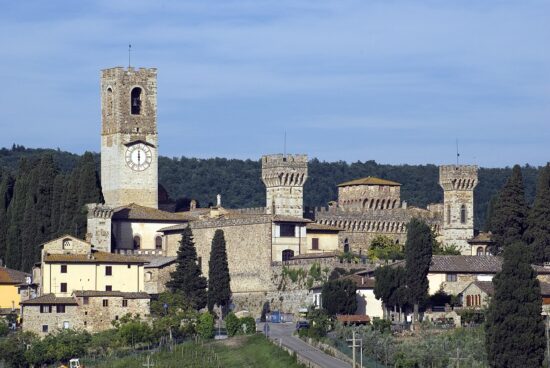
Within Tavarnelle itself, the Church of Santa Lucia al Borghetto is the most interesting architectural sight, being a rare example of Tuscan Gothic architecture. Nearby there are several extremely interesting structures, notably the parish church of San Donato in Poggio, the parish church of San Pietro in Bossolo which now houses the Museum of Religious Art of Tavarnelle, and the large and important monastery of Badia a Passignano.
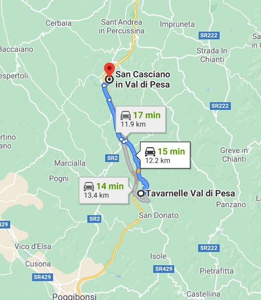
From Tavarnelle Val di Pesa to the last stop on the way back to Florence, San Casciano. The position on the Roman crossroads made it easy for San Casciano to prosper economically until well into the 1400s. Its strategic position made it one of the more popular stops on the road to Rome.
The findings of Etruscan and Roman artifacts have definitely dated the city – and have explained the original name, San Casicano in Decimo – referring to its position at “milemarker” decimo on the Roman road between Fiorentina and Sena Giulia. The “decimo” suffix was lost over time and replaced with a reference to the valley and river val di Pesa (sometimes written as San Casciano VP).
Like so many towns that spurted up along the Florence border, it was considered a strategic military outpost, protecting the medieval city of Florence from invasion. But San Casciano didn’t start its life that way; it was a classic market town set low in the valley and thus it grew up with hardly any defenses making it an easy target for hostile takeovers. More about San Casciano. This village is half an hour away from the city of Florence.