Spreeinsel
Where do I begin? Where do I start from? Well, a good introduction to Berlin’s universe would be the Spreeinsel (Spree Island) in the historic heart of the German capital. Since the founding of Berlin and Kölln on the sand islands in the Spree, the river has played an important role for the former twin cities.
The medieval trading cities of Berlin and Kölln owe their location on the water to their security and economic prosperity, and their structural and historical development is closely linked to the Spree. The Spree was a traffic route, a transshipment point, and a supplier of energy. Linen was washed on the banks and bathed in the river baths. The center of Spree island, as a former sovereign territory, is one of the most important locations in German history.
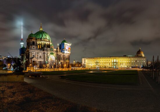
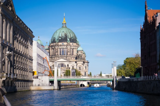
The Berlin City Palace, the residence of the Brandenburg electors, the Prussian kings, and the German emperors, was located here for almost 500 years. The Spreeinsel, surrounded by the navigable Spreearm in the east and the narrow Spree Canal in the west and south, is not only the actual historic heart of today’s metropolis but also the place where one can immerse in the rich German culture and art.
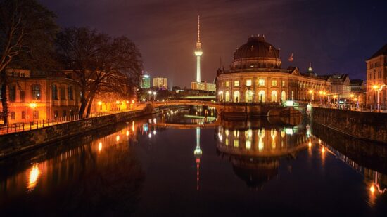
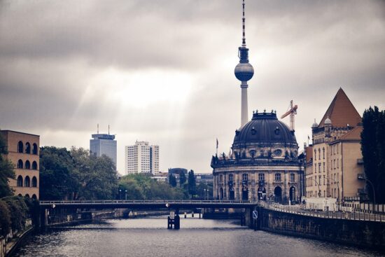
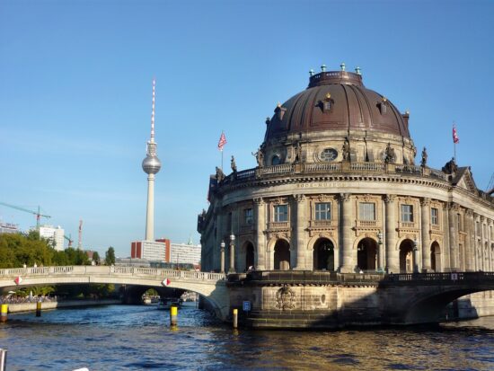
The oldest Spree crossings can be found here, the Mühlendamm and the Long Bridge, but also valuable historical evidence such as the Schloßbrücke, the Jungfernbrücke, and the Gertraudenbrücke. The city’s eventful history can still be experienced here today. At the northern tip of the Spree island, the theme of Berlin by the water is practically celebrated with the Bodemuseum growing out of the water and the double bridge that crosses both the Spree and the Spree Canal.
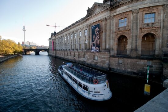
On the west side of the island, where the Spree Canal is named Kupfergraben, The Pergamon Museum, which is located directly on the water, also dominates the waterside. Then, between the Eiserner Brücke and Schloßbrücke, the Lustgarten opens up to the canal and presents the famous panorama of the former residential area with the base of the national monument on the former Schloss Freiheit and the buildings along the Friedrichsgracht up to the Gertraudenrücke.
The small-scale development of the Friedrichsgracht from the pre-war period has been replaced by the garden of the State Council building and a long apartment building from the GDR era. Only the historic bridges, the Jungfern bridge- and Gertraudenbrücke, which span the Spree Canal, the parsonage of the Petrikirche, and a small residential and business complex on the Gertraudenbrücke, still remind us of the situation before the Second World War.
High-rise residential buildings from the 1970s dominate the scene on Fischerinsel today and form a contrast to the small-scale development of Neukölln on the waterfront, which largely dates back to the 19th century. In the southeast, at the confluence of the Spree and Spree Canal, the water area widens; the so-called “Historic Harbor” is located between Mühlendammschleuse and Märkischer Ufer.
The Berlin Spree Canal, a 1.8-kilometer-long, straightened arm of River Spree surrounded by embankment walls, was Berlin’s most important waterway until the Spree was converted into a large shipping route at the end of the 19th century. This watercourse was of enormous importance for the development of the medieval twin city of Berlin-Kölln: it was a vital trade route, and supplier of energy (mills) and served as a moat in front of the medieval city wall for defense. This importance can hardly be seen today, after the war destruction and the associated extensive loss of the historical bank development.
With the reorganization of the inner city in GDR times, the structure of the adjacent buildings has changed significantly, so today only the bridges give references to formerly important squares and streets by their names. Not used for shipping since 1913, it has not even been passable for small pleasure craft since 2005. Nothing today reminds us that this canal was once Berlin’s lively lifeline.