
Petrusse valley
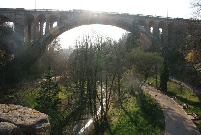
Exiting the Petrusse casemates at the bottom of the wall one enters the historic Petrusse valley. a large city park full of willows & cherry trees separating Ville Haute from the rest of the city. This canyon park surrounding Petrusse river is the connecting tissue between the two wonderful bridges, Pont Adolphe to the west and Pont Viaduc or Passerelle to the east.
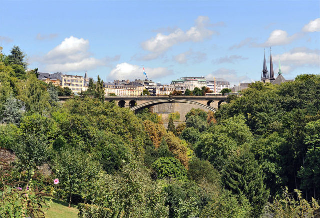
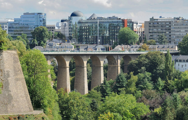
The valley is mostly closed to automobile traffic and is in its greatest part used by walkers, joggers, and cyclists. The valley offers a perfect view of the two striking bridges, a close view of the defensive wall & its gun ports as well as the derelict remains of an old sluice, also part of the old city defenses. The sluice could be opened to flood the valley if the city was threatened by invaders. If you decide to head eastwards, in the shadow of the towering Viaduct, nestled behind leafy trees, carved into the rocky valley wall is the Chapelle Saint-Quirin.
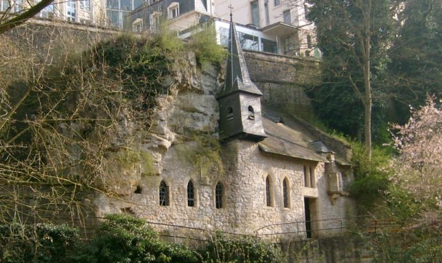
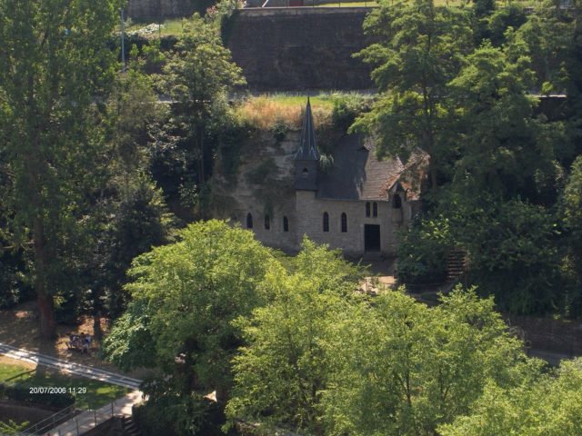
There are no signs or plaques on site to hint at the name or history of the chapel but according to the local tradition this was originally carved by the Celts in the very early days of the city. It was originally used by the Romans as an early Christian sanctuary and it is known to have housed a chapel since at least the 4th century. This chapel dates back to 1355 and is named after Saint Quirin of Neuss who was 1544 to 1666 the patron saint of Luxembourg Ville.
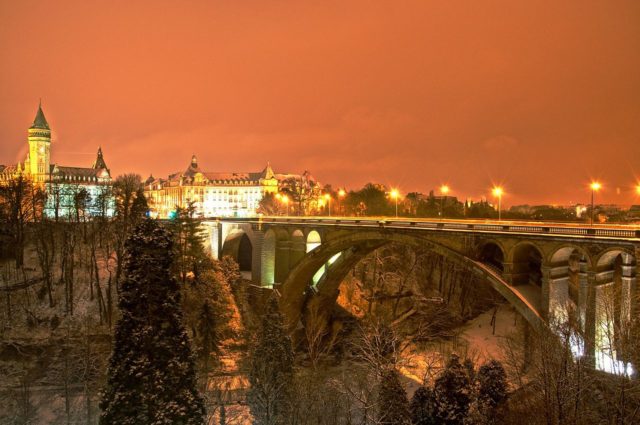
One can follow the paved walkway to the end of the park and the River Alzette, into the small valley town of Grund. To the west and the impressive 42 meters high and 153 meters long Adolphe Bridge, a national symbol and one of the city’s main attractions is today under major reconstruction. The bridge had the biggest stone arch in the world at the time it was built(1903) with the big double arch spanning 85 meters across the valley.
On the top, facing the Casino, on the balcony of the Petrusse (boulevard Franklin Roosevelt) one can find everything he or she wants to know about the bridge’s history & the advancement of the building site in the smallest details in the exhibition Nei Bréck. Visible from the Petrusse valley is the conspicuous round tower of one of the most imposing buildings in the city in the semi-lunar Place de Metz that marks the south end of Pont Adolphe, on top, the State Savings Bank building.
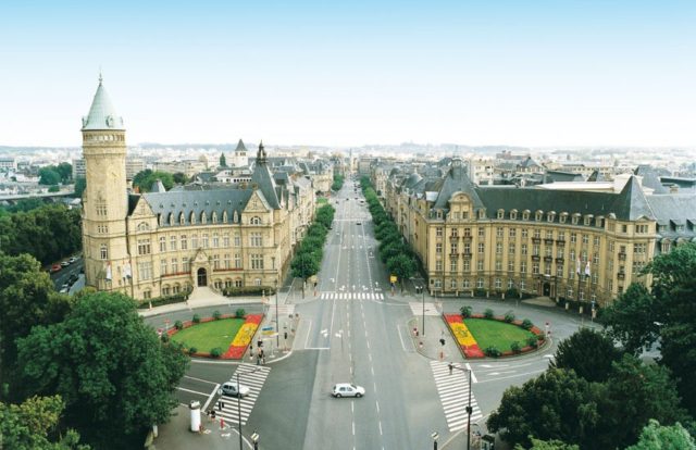
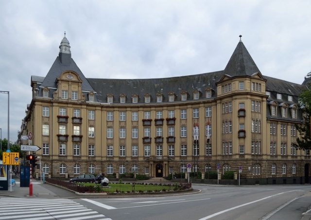
This striking piece of real estate was constructed by a native architect in 1909 for the State Savings Bank in neo-Renaissance style and became 1952 the headquarters of the High Authority of the European Coal and Steel Community (E.U’s predecessor).On the other end of the bridge, we find the Casino Luxembourg-Forum d’art contemporain.