Dam Square
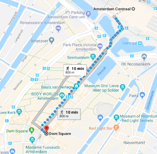
Dam Square is the most iconic public square in Amsterdam. Five minutes west of the Hemp Museum lies the historical center of the city of Amsterdam. According to most modern guides the city gradually evolved around this square after 1270. According to historians on the other hand the first natural inlet was located right in front of the Centraal Station.
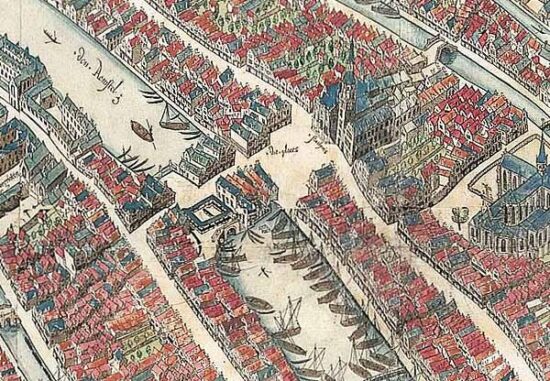
Several drainage ditches (that helped farmers turn swamps into fertile land) and dikes (protecting those farmers from floods) that date back to the 11th century have been found all along the Amstel River. The natural harbor that was formed by Amstel’s estuary (where the river flowed into the IJ) was where Damrak street lies today (It connects the Centraal Station with Dam Square).
The dike that gave the first permanent settlement the ability to exist ran from the Central station on the north to Dam square and continued south along Nieuwendijk. The first houses were built along Nieuwendijk and date back to the mid-1220s. They are currently at a depth of 5 to 6 meters below the current street level.
By 1250 about 500 people were living along the east side of the dike (Damark today). Around 1265, the feudal lord that governed the area around Amstel River in the name of the bishop of Utrecht and the count of Holland ordered the construction of a sluice at the location of the Dam square.
The sluice could control the flow of water closing during high tide and opening during low tide. That way the ships were able to sail right up to it and unload their cargo. Soon warehouses and flea markets were set up at the point making it the center of economic life.
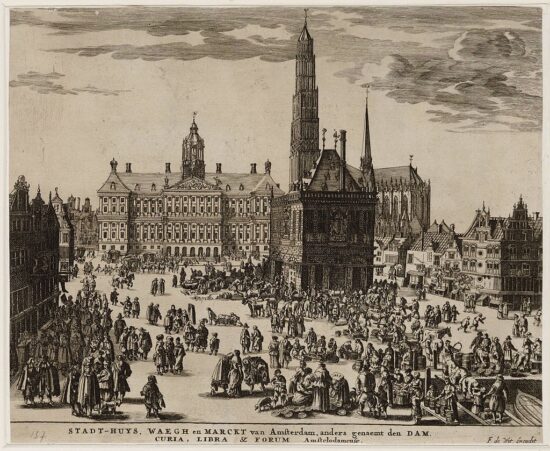
By the year 1340, the square had grown enough to host a Waag, an official weigh house, where all goods unloaded by the ships were weighed by town clerks. Soon after the preparations for the first city hall on the site started and in 1395 it was finally ready. It would dominate the west side of the square for 252 years.
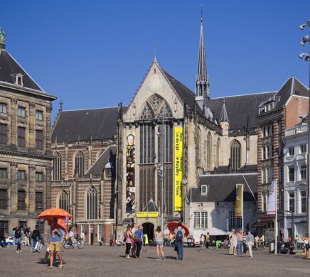
With the city growing exponentially a second big church (Oude Kerk was the first) was urgently needed and in 1408 the Bishop of Utrecht gave his permission for Nieuwe Kerk, the New Church that was inaugurated a year later on the northwest side of the square.
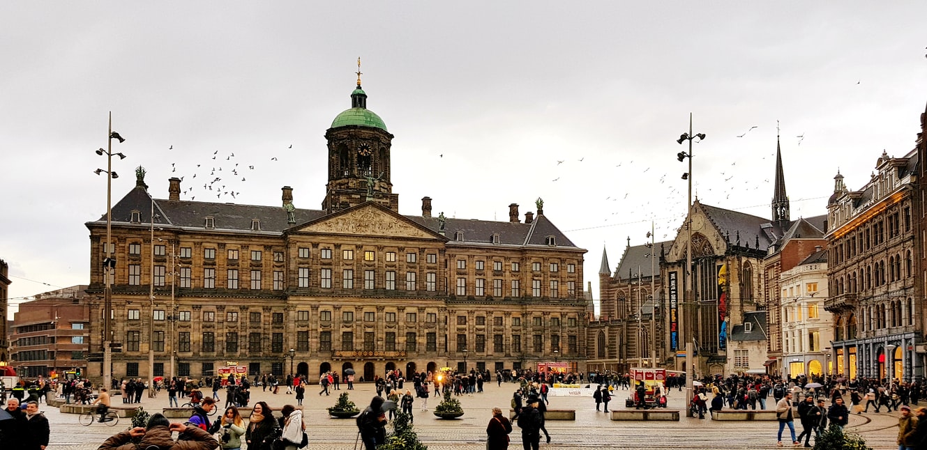
The Old Town Hall stood on the west side until 1652 when the fire became the catalyst for the construction of a new more impressive town hall (now the Royal Palace on the Dam) that would express the wealth and power of 17th-century Amsterdam.
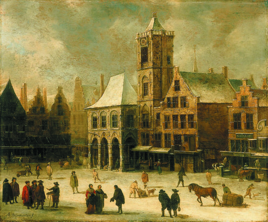
Up to the year 1840, the ships could moor at the Dam but the following year the Damrak current was filled and the square started taking its modern form. The latest addition to the square came in 1956 with the National Monument dedicated to the victims of WWII that dominate the east side with its 22 meters high pillar.
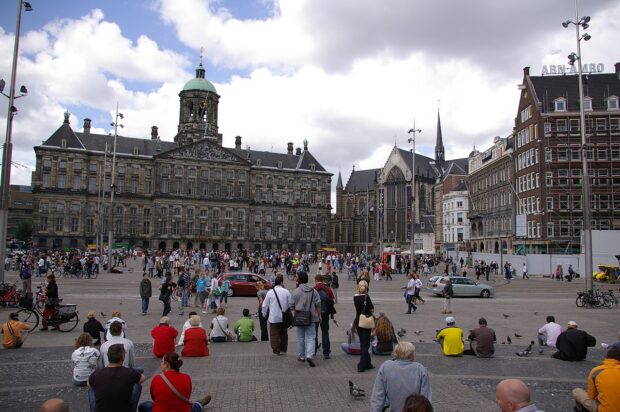
Today Dam square is still an epicenter of social life for locals and tourists alike. It is the location of the world-famous Madame Tussauds Museum & the Grand Hotel Krasnapolsky, the largest five-star hotel in the Netherlands. It is also a place where you can find several department stores, restaurants & cafes where you can sit & take it all in. It is also a favorite for each year’s Christmas market when it is exceptionally lit and more pretty than ever.